SkyGrid, a Boeing, SparkCognition company, has launched a new app for drone operators and enterprises to automate every phase of flight in one unified solution. Now available for free in the iPad App Store, it simplifies mission planning and execution, allowing drone operators to autonomously surveil a defined area and detect objects in real-time, according to Amir Husain, CEO and founder of SkyGrid. Powered by artificial intelligence (AI) computer vision, the solution enables more efficient search and rescue missions, disaster response, perimeter surveillance, site inspections, and more, he adds.
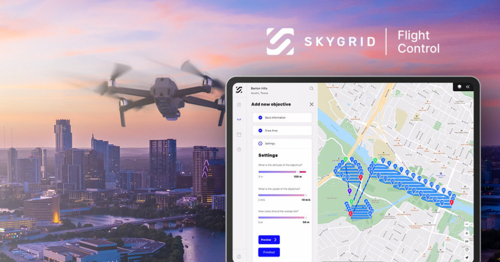
Powered by SkyGrid’s AerialOS, SkyGrid Flight Control enables drone operators to automate airspace authorization, mission planning, flight execution, and object detection in one end-to-end solution. The following features and functionality are available for free within the iPad application:
- Airspace intelligence: Provides a map of airspace classes, boundaries, temporary flight restrictions, notices to airmen, and other advisories.
- Ground intelligence: Displays population density, obstacles, elevation, and more.
- Advanced weather data: Details hyper-local precipitation, wind speed and direction, temperature, cloud cover, and more.
- Real-time airspace authorization: Automates authorization to fly in U.S. controlled airspace under 400 feet through integration with the Federal Aviation Administration’s Low Altitude Authorization and Notification Capability (LAANC) 4.0.
- Automated mission planning: Automatically generates area exploration, waypoint, and multi-objective missions based on custom flight parameters, such as desired speed, altitude, and location.
- Autonomous flight execution: Autonomously launches the drone and performs the pre-defined flight plan.
- AI object recognition: Detects objects in real-time as a drone surveils the defined area with AI computer vision.
More advanced enterprise features are also available for organizations to better manage all drones, pilots, and airspace operations. These features include AI-based mission planning and rerouting, multi-drone missions, custom object detection and counting, geofencing and alerts, and more.