An Apple patent (number 20110050706) for modifying graphical paths has appeared at the US Patent & Trademark Offices. It indicates that Apple has plans to further beef up the Faces and Places features of iPhoto — and perhaps incorporate such technology in other apps, as well.
A computing device includes a memory configured to store images and associated timing data. The computing device also includes a processor configured to execute instructions to perform a method that includes producing a graphical path on a digital map that represents positions associated with the images. The positions are estimated from the timing data associated with the images. The method also includes modifying the graphical path based upon data that represents user provided adjustments to the estimated positions of the images. The method also includes presenting the modified path. The inventors are Tim Cherna, Nikhil Bhatt and Alexander David Wallace.
Here’s Apple’s background and summary of the invention: “In the expanding fields of personal computing and electronic devices, more and more features and functionality are being incorporated into portable devices. For example, cellular telephones may include cameras (for gathering images and video) and high resolution displays (for presenting various types of imagery and graphics) while still providing telecommunication functions (e.g., for placing and receiving telephone calls). Due to their robust processing and computational resources, such devices may provide various functions for professional and recreational applications. As such, data (e.g., images and video) may be collected and processed for presentation and storage.
“Disclosed herein are systems and methods for developing paths of position data from time data and a collection of images. For example, a series of time-stamped images collected by a portable computing device such as a cellular phone may be used to produce a graphical representation of a traveled path. Once produced, the representation of the path may be modified, for example, by introducing additional images that are associated with locations near the traveled path. Further, information provided by a viewer that reflects adjustments in the traveled path may also be used for path modifications.
“In some implementations, a computing device includes a memory configured to store images and associated timing data. The computing device also includes a processor configured to execute instructions to perform a method that includes producing a graphical path on a digital map that represents positions associated with the images. The positions are estimated from the timing data associated with the images. The method also includes modifying the graphical path based upon data that represents user provided adjustments to the estimated positions of the images. The method also includes presenting the modified path.
“In other implementations, a method includes producing a graphical path on a digital map that represents positions associated with images. The positions are estimated from timing data associated with the images. The method also includes modifying the graphical path based upon data that represents user provided adjustments to the estimated positions of the images. The method also includes presenting the modified path.
“In other implementations, one or more computer readable media store instructions that are executable by a processing device, and upon such execution cause the processing device to perform operations that include producing a graphical path on a digital map that represents positions associated with images. The positions are estimated from timing data associated with the images. The operations also include modifying the graphical path based upon data that represents user provided adjustments to the estimated positions of the images. The operations also include presenting the modified path.”
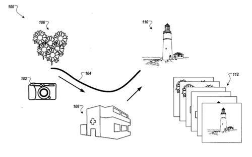
Along the same lines, an Apple patent (number 20110055283) for reverse geo-coding for a track path has appeared. Methods and systems are disclosed for associating non-geographical information to track paths. Among other things, meaningful labels for the track paths can be formulated. In one aspect, a method performed by an application executing on a computer system includes receiving a set of images taken during a trip, a corresponding set of acquisition times, and a track path of the trip. The method further contains identifying landmarks near the received track path.
Furthermore, the method includes receiving from a human user of the application a landmark selection from the identified landmarks and one or more image selections from the received set of images. In response to receiving the human user’s selections, the method can associate the one or more selected images with the selected landmark. Additionally, the method included matching the received set of images to the received track path based on the association. The inventors are Alexander David Wallace, Tim Cherna, Erik Hanson and Nikhil Bhatt.
There are also three other new patents with similar goals. Number 20110055284 is for associating digital images with way paths. In one aspect, a method performed by an application executing on a computer system, includes receiving at least two sets of digital images including a first set of digital images for which image acquisition times are known and a second set of digital images for which image acquisition times and image acquisition locations are known. The method further includes overlaying waypoint identifiers over a map image. The waypoint identifiers correspond to geographical coordinates and to time acquisitions of one or more of the second set of images.
Furthermore, the method includes receiving from a user associated with the application a waypoint selection of the overlaid waypoint identifiers and one or more image selections of the first set of images. In response to receiving the selections, the method includes associating the selected ones of the first set of images with the selected waypoint, and generating a trip-descriptor including the first set of images associated with the overlaid waypoint identifiers. The inventors are Alexander David Wallace, Tim Cherna, Erik Hanson, Nikhil Bhatt and Mark Lee Kawano.
Patent number 20110052073 is for landmark identification using metadata and apparently involve the Places feature of iPhoto. Methods, systems, and apparatus are presented for associating a point of interest with a captured image. In one aspect, metadata associated with a digital image can be accessed, the metadata identifying an image capture location. Further, a depth of field corresponding to the digital image can be determined and one or more points of interest can be identified that are located within the determined depth of field. Additionally, one of the one or more identified points of interest can be selected as an image subject and the metadata associated with the digital image can be edited to include data identifying the selected point of interest. The inventors are David Alexander Wallace, Tim Cherna, Eric Hanson and Nikhhil Bhatt.
Patent number 20110055749 involves tracking device movement and captured images. Per the patent a computing device includes a memory configured to store position data and images. The computing device also includes a processor configured to execute instructions to perform a method that includes receiving position data that represents the positions of a position tracking device over a period of time. The position data includes a group of position coordinates that represent a location.
The method also includes receiving images that include a group of images associated with the location. The method also includes aligning the group of position coordinates that represent the location and the group of images associated with the location. The method also includes presenting a representation of the alignment of the group of position coordinates and the group of images. The inventors are David Alexander Wallace, Nikhil Bhatt, Tim Cherna, Eric Handson and Mark Lee Kawano.
— Dennis Sellers