PCI Geomatics, a developer of remote sensing and photogrammetric software and systems, has teamed up with IAVO for the release of 3D FeatureXtract (3DFE).
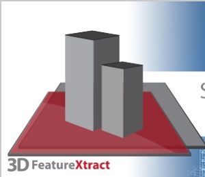
By calculating feature heights and outlines of overlapping satellite or aerial imagery, 3DFE can model 3D features in a 2D environment, and it does this without any need for specialized hardware. The software was developed by scientists at IAVO, a research and development company based in Durham, North Carolina.
“3D FeatureXtract will allow customers to easily derive building footprints, a key requirement for producing true ortho image products from satellite or aerial imagery,” says Peter Hazlett, desktop product manager at PCI Geomatics. “3DFE is easy to use and requires no special hardware — anyone with basic computer skills can learn how to model in 3DFE in a matter of minutes.”
PCI Geomatics is the global distributor for the software, with additional distribution through its international reseller network. To find out more, and to download an evaluation version of the software, go to www.pcigeomatics.com/3DFE .