

Apple has been granted a patent (number 11,084,786) for “navigation using augmented reality.” It involves future features of the tech giant’s Maps apps.
About the patent
In the patent data, Apple notes that modern mobile devices such as smartphones can run applications that help navigate the user from one location to another. These navigational applications can utilize GPS coordinates to determine the location of a mobile device and plot an intended travel route that can be used to guide the user from the location to a destination location.
As the user traverses the intended travel route, such applications provide a top down view of a grid of streets and directional data to instruct the user where to turn along the intended travel route. The directional data can include symbols, such as arrows, for guiding the user along route.
However, Apple says that “the time and effort required by the user to interpret these symbols can inhibit the ease at which the intended route is traversed and can lead to misdirection.” The tech giant thinks that adding augmented reality (AR) features can help overcome such limitations.
Summary of the patent
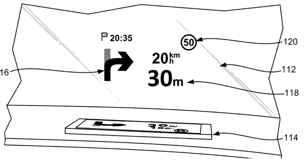
Here’s Apple’s abstract of the patent: “Embodiments disclose a computer-implemented method for guiding a user along a route, the method including receiving route information from a route server, where the route information includes geographical positions of roads and designated lanes of travel for each of a plurality of segments along the route, and receiving a series of images captured by the camera along the route.
“The method includes analyzing the series of images to determine a horizon and one or more available lanes of travel along the route, identifying one or more designated lanes from the one or more available lanes based on the analyzing of the series of images, and displaying the series of images along with a navigational layer superimposed over the series of images to the user, the navigational layer comprising a blocked region covering areas of the series of images outside of the one or more designated lanes and below the horizon.”
Article provided with permission from AppleWorld.Today