

Xeric Design (www.xericdesign.com) has launched a new cloud image service for EarthDesk Data subscribers.
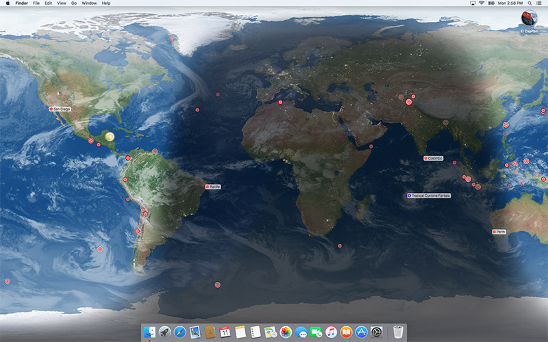
The cloud image is now precisely geo-located and parallax-corrected, contains data from up to 23 satellites, and includes polar coverage. The folks at Xeric Design say they’ve worked with the Space Science and Engineering Center’s RealEarth project at the University of Wisconsin, Madison to bring this high-quality data feed to EarthDesk. Previously, only six satellites were used and the data did not extend to the poles.
EarthDesk replaces your static desktop with an image of the Earth showing current sun, moon and city illumination, as well as near real-time cloud coverage. The software allows users to purchase an optional data subscription that offers the new precision clouds with 16 times more detail than the standard cloud layer. In addition, this service displays real-time data including worldwide earthquakes, named storms (typhoons, hurricanes, etc.) and the position of the International Space Station.
EarthDesk is compatible with macOS 10.10 and higher. It costs $24.99 for singles user licenses. Upgrades to the latest version are $12.99 for licensed users of versions 5 and 6. A data subscription adds precision clouds, earthquakes, named storms and tracking of the International Space Station starting at $11.99 per year. Bundles that include EarthDesk and a discounted data subscription are available.